 |
 |
|
|
DATA MANAGEMENT
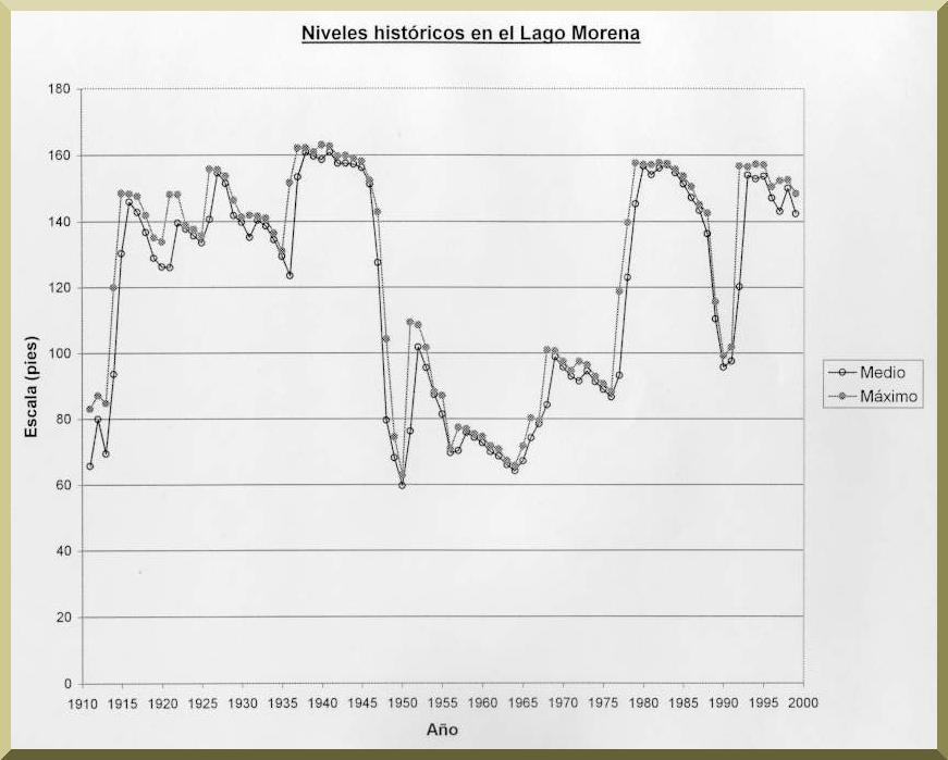
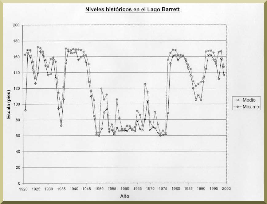
The total basin area of Cottowood Creek - Arroyo Alamar watershed is 1387 km2. 24-hr design storms were selected for the 2-, 5-, 10-, 25-, 50- and 100-yr return periods. The Gumbel method was utilized to extend the precipitation data to 200, 500 and 1000 yr. The data on monthly levels for Morena and Barrett Dams corresponding to the periods of record (1912-2000 for Morena Dam and 1922-2000 for Barrett Dam) was analyzed to determine the average monthly level (AML) for each month of the year, from which the mean AML and the maximum AML were obtained. The data of elevation-volume-discharge for Morena and Barrett Dams were provided by the Department of Water of the City of San Diego. 50 stream cross-sections were measured in San Diego County and the municipalities of Tijuana and Tecate. The infiltration velocity, on which the calculation of the channel transmission losses are based, is estimated using similar experience and recommendations of hydrology manuals. For purposes of this study, a mean value of 2 in/hr (0.000014 m/s) was adopted for Cottonwood Creek - Arroyo Alamar and tributaries.
|
 |
|
|
RESULTS |
METHODOLOGY |
main page |