| |
|
VIVA EL PERU, KARAJIA!
Text and Photos by Victor Miguel Ponce
During a visit to Sipán, outside Chiclayo, Peru, in January of 2002,
an acquaintance described Kuelap to me in glowing terms.
Subsequently, I read
"Chachapoyas, Guía del Viajero," by Peter Lerche
and got a brief glimpse of the sarcophagi of Karajía.
That's when I decided to visit Amazonas,
in the hope of documenting these little known archaeological wonders.
I returned to Chiclayo in August 2002,
hired a guide and a driver and, 10 hours later, reached Estancia Chillo,
on the Río Utcubamba, about an hour's drive from Chachapoyas, the capital of Amazonas.
There, I planned my outing that would take in the Kuelap fortress,
the Revash necropolis, the Karajía sarcophagi, the Makro citadel, and the Pitaya petroglyphs,
all within driving distance from Chillo
(http://estanciachillo.com).

| |
|
Monday was Kuelap.
At a distance of 2 hours West of Chillo, it looked like we would never get there as we drove over narrow
winding roads along steep precipices.
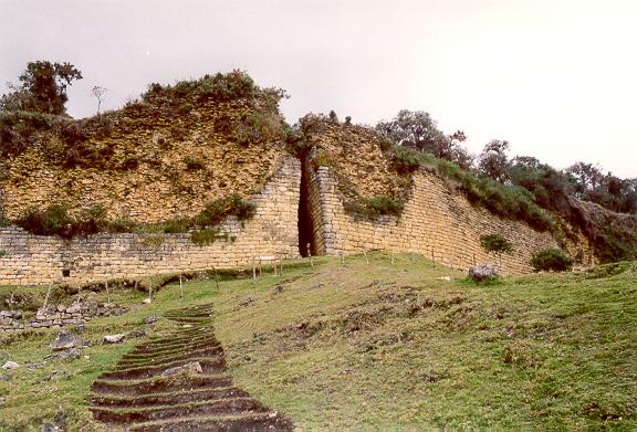
Kuelap was everything it was supposed to be and more: a magnificent fortified city built by the Chachapoya,
perhaps as early as 800 AD. Half reclaimed by nature, it stands on top of Cerro Barreta,
a monument to time. The high outer stone wall surrounds hundreds of circular and a few rectangular dwellings,
many featuring distinctive geometric friezes. The three narrow entrances are particularly fascinating,
inviting spirited speculation as to their design and function.

| |
|
Tuesday we set out for Revash.
We secured horses to climb Revash mountain, about an hour-and-a-half South of Chillo.
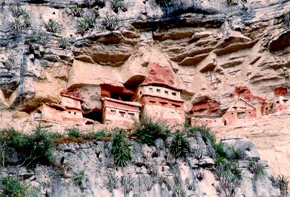
The scenery was unforgettable: On a narrow ledge in the middle of a high cliff
the Chachapoya built several funerary buildings
colorfully painted, predominantly in red ochre.
We shied away from actually setting foot on Revash, but were able to photograph it
with the help of my Minolta 300 mm zoom lens.
Revash is barely visible from the road; one has to climb the mountain to admire it from
a close distance.
Wednesday it was Karajía.
This is the site that interested me most.
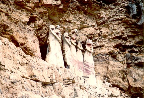
The cliff with the six sarcophagi, a tribute to Chachapoya culture,
is near the remote hamlet of San Miguel de Cruzpata, about three-and-a-half hours northwest of Chillo.
In nearby Chota, we were joined by two would-be guides, Marllori, 12, and Jacoba, 10,
who cheerfully helped to make our visit all the more enjoyable.
The sarcophagi, locally known as purunmachus, represent both men and women.
They were built by covering
a framework of cane with a plaster of mud and decorated in red and yellow ochre on a white background.
Their state of conservation is remarkable,
given the passage of time and the inclement climate.
The Karajía sarcophagi resemble the famed Easter Island statues,
but the similarity would appear to end there.

| |
|
Thursday we traveled to Makro.
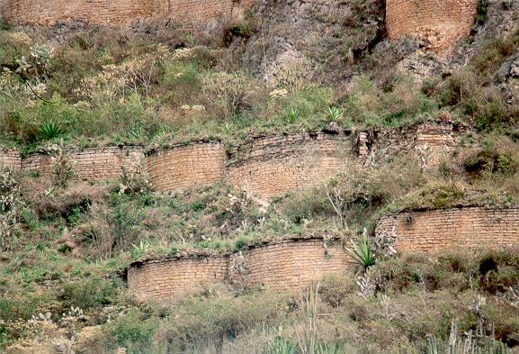
This Chachapoya citadel consists of about 60 circular buildings, built on the side of a mountain,
near the town of Magdalena, 15 minutes North of Chillo.
The citadel is in amazingly good shape. Set on the side of a near
vertical mountain, it must have been for defense.
In the 15th century, the Chachapoya were at war with the Incas, who
eventually succeeded in conquering the southernmost edge of their land.
Here again, the scenery is impressive, with the Río Utcubamba lying
at the foot of the canyon.
Friday it was on to Pitaya
and the return to Chiclayo. In Pitaya, about an hour-and-a-half North of Chillo,
there are several petroglyphs reported
to be more than 2000 years old.
The trip back regaled us with magnificent views of the deep Utcubamba canyon,
complete with large whitewater rapids, high cataracts,
and some of the most intriguing geologic features I've ever seen.
The Amazonas region is predominantly ceja de selva,
literally "the jungle's eyebrow,"
i.e., the lower slopes of the Eastern Andes,
as they kneel down to pay their respects to the mighty Amazon rainforest.
Victor Miguel Ponce teaches civil engineering at San Diego State University.
He has a long-standing interest in South American travel and exploration,
having authored several articles for South American Explorer,
including "Humboldt on Geophagy" (Issue No. 55). He can be virtually visited at
http://ponce.sdsu.edu