|
WHAT IS THE DISTANCE FROM LONDON TO PARIS AS THE CROW FLIES?
Professor Emeritus of Civil and Environmental Engineering
San Diego State University, San Diego,
California
1. INTRODUCTION
In this article, we demonstrate the use of
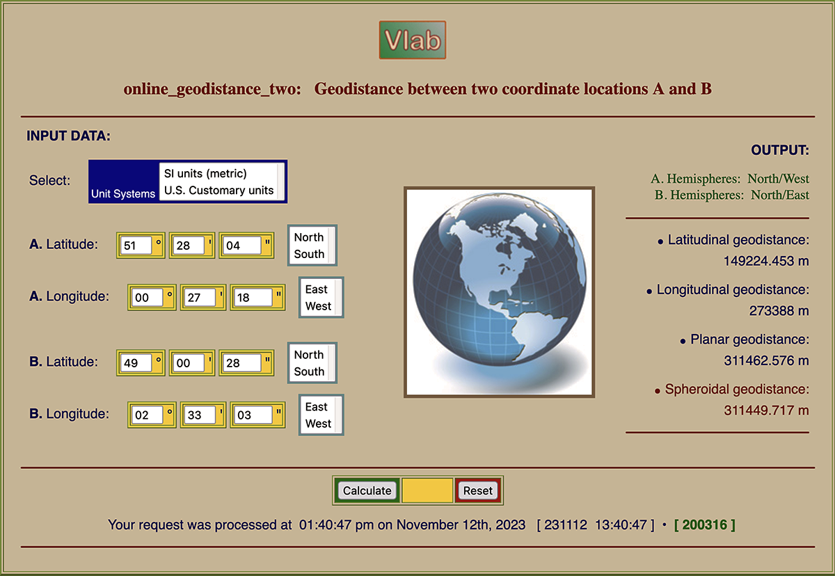
the online calculator ONLINEGEODISTANCETWO to evaluate the distance, as the crow flies, between two
arbitrarily selected geographical locations A and B on the
Earth's surface, each properly identified by their respective coordinates: Latitude and longitude. We describe the use of the online calculator by means of a clear example.
2. PROCEDURE
The procedure consists of the following steps:
Select the geographical locations A and B.
Find the coordinates of point A. You may want to use
Google Earth® to accomplish this task.
Find the coordinates of point B. You may want to use
Google Earth® to accomplish this task.
Enter the coordinate data for points A and B
into the online calculator ONLINEGEODISTANCETWO.
Run the online calculator to find the (spheroidal)
geodistance between points A
and B.
3. EXAMPLE
This section provides an example of the use of online_geodistance_two.
The objective is to calculate the distance between Heathrow airport, in
London, United Kingdom, and Charles de Gaulle airport, near Paris, France.
The geographical coordinates are obtained using Google Earth as follows:
B. Charles de Gaulle airport: Latitude 49° 00' 28" N, Longitude 02° 33' 18" E.
The spheroidal geodistance between Heathrow (London) and Charles de Gaulle (Paris)
airports is: 311,449.717 m, or 311.450 km.
4. CONCLUDING REMARKS
We have used the online calculator ONLINEGEODISTANCETWO
to determine the
distance between Heathrow airport, in London, United Kingdom, and Charles de Gaulle airport, near Paris,
France. This online tool may be used to determine the geodistance between any two locations on the Earth's surface,
once the geographical coordinates are known.
|
| 231112 |

